More than 700 Acres of Historic Land Protected at James Madison’s Montpelier

More than 700 acres of land at James Madison’s Montpelier, the home of the Father of the Constitution in Orange County, was permanently protected today through a unique public-private partnership. The Piedmont Environmental Council (PEC) worked with the Virginia Outdoors Foundation (VOF) and the Virginia Department of Historic Resources (DHR) to purchase conservation easements on four areas of Montpelier from the National Trust for Historic Preservation and The Montpelier Foundation.

“We are thrilled to work with The Montpelier Foundation and the National Trust to protect this critical historic resource,” said Chris Miller, President of the Piedmont Environmental Council. “Everyone involved felt it was important to move forward with these conservation easements as soon as possible. Montpelier is one of America’s most important and best preserved historic sites, a place that inspired Madison and his thoughts about the Constitution and the future of the United States. Montpelier is the heart of the Madison-Barbour Rural Historic District, is a critical focal point of the Journey Through Hallowed Ground National Heritage Area, contains important Civil War sites, and is the center of heritage tourism in Orange County, with more than 100,000 visitors each year.”

“We hope that the National Trust’s and Montpelier Foundation’s obvious dedication to preserving rural Orange County will help spur other landowners in the area to consider conservation options for their property,” said Jack Snyder, PEC Board Member and Orange County resident. “In the past 20 years, more than 2000 acres immediately surrounding Montpelier have been placed into conservation easement.” See attached map.

These easements will protect four distinct portions of the large Montpelier estate. The East Woods, a 200 acre forested tract is adjacent to the “Landmark Forest,” a nationally recognized old-growth Piedmont forest that is already protected by an easement. Also conserved is Chicken Mountain, a prominent, 245-acre forested tract in the Somerset area. Preservation of these tracts helps to conserve the water quality in local streams, as well as the forested backdrop to Montpelier and the surrounding countryside.

The historic Gilmore Farm, a small 19-acre parcel, will also be protected by the conservation easements. This parcel is the site of the restored home of George Gilmore, a former slave at Montpelier who lived there with his wife Polly and their family. A large Civil War Encampment site, immediately adjacent to the Gilmore Farm, was occupied during the winter of 1863-1864 by troops from Gen. Lee’s Army of Northern Virginia, before they fought at the Battle of the Wilderness. Easements on these properties will protect these cultural assets and make them available for the public benefit

“These four easements at Montpelier, protecting streams, forests, a Civil War encampment, and the home of one of James Madison’s former slave, George Gilmore, demonstrate the power of collaboration between conservationists and preservationists,” said Richard Moe, president of the National Trust for Historic Preservation. “We hope these easements will spur additional protection around James Madison’s Montpelier and serve as a model for other projects. We would like to thank the Piedmont Environmental Council, the Virginia Department of Historic Resources, the Virginia Outdoors Foundation and The Montpelier Foundation for their work on this innovative collaboration.”

Moe also noted that proceeds from the sale of the easements will go towards Montpelier’s endowment, ensuring the future fiscal integrity of this important historic place

“The Montpelier Foundation is extremely pleased with this partnership and the resulting conservation easements that will protect this national treasure,” said Michael C. Quinn, president of the Foundation. “With these easements, we are ensuring that future generations will be able to experience the extraordinary range of Montpelier’s heritage, just as it has been preserved today.”

The help of the Commonwealth of Virginia in protecting this land was vital. The Virginia Outdoors Foundation and the Virginia Department of Historic Resources provided technical assistance and advice on the easements, as well as serving as co-holders of the easements with the PEC. Funding from the Virginia Land Conservation Foundation, coupled with private donations helped make these easements a reality.

“VOF is pleased to be part of the effort to permanently protect portions of Montpelier with conservation easements and commends the National Trust and The Montpelier Foundation for their foresight and commitment to land conservation. Not only are the lands protected part of the highly significant historic home of President James Madison, but the lands also adjoin approximately 8,500 acres of contiguous land in easement to VOF. With the two newly recorded easements and the existing Nature Conservancy easement on the Landmark Forest portion of Montpelier, a contiguous block of over 9,000 acres is now permanently protected within the Chesapeake Bay watershed, nearly all of which is in the Madison-Barbour Historic District. VOF thanks Piedmont Environmental Council and Virginia Land Conservation Foundation for making these easements possible,” said Hank Hartz, chairman of the Virginia Outdoors Foundation.

“Once again, the National Trust and The Montpelier Foundation have set the mark for leadership, and the Commonwealth and the nation are the grateful beneficiaries,” said Kathleen S. Kilpatrick, Director of the Virginia Department of Historic Resources. “Taken together these four easements preserve and protect an amazing complement of diverse and outstanding resources, and we are proud to be a partner in ensuring that they are passed along for the future.” Speaking of the encampment site, she noted that, “The roughly 245 acre Civil War site is the largest documented intact encampment site in the country, and it includes five known camps. The rich archaeological resources will be available for future study and education to expand our knowledge and understanding of the Civil War era.”

Speaking of the Gilmore Farm site, Ms. Kilpatrick stressed that “This is an extremely rare resource and a uniquely powerful place with the capacity to connect us to the Freedman’s experience and the struggles, the hopes, and the triumphs they faced in the years after emancipation. George and Polly Gilmore built a home and a new life together for themselves and their family on this farm, raising eight children in that cabin. One of the great honors of the experience of working to achieve recognition for the preservation of the Gilmore’s farm has been to come to know their descendants and to witness the pride they have in the achievements of George and Polly.”

The four easements at Montpelier were purchased by PEC using private donations and a $700,000 grant from the Virginia Land Conservation Foundation (VLCF). The easements were finalized this month to meet a critical deadline of the grant, although the fundraising goal has not been met. The Piedmont Environmental Council and The Montpelier Foundation continue to seek the remaining funding necessary to cover the full costs of these important conservation easements.
Historic Ingles Ferry Farm Permanently Protected

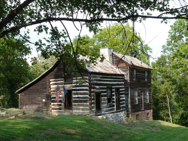
Ingles Ferry Farm, one of Southwest Virginia’s most significant historical sites, is now fully and forever protected. The property’s three owners, all direct descendants of pioneer heroine Mary Draper Ingles, have donated a permanent conservation easement to the Virginia Outdoors Foundation (VOF) and the Virginia Department of Historic Resources (VDHR). The New River Land Trust (NRLT) also played a key role in the project by securing funding for it through the Virginia Land Conservation Fund, which leverages federal, state, local and private funding to conserve land in the commonwealth.

The 313-acre tract in Pulaski County is part of the ancestral home of Mary Draper Ingles, an American pioneer who was captured by Shawnee warriors in 1755 and taken to an area near present day Cincinnati, only to escape and walk hundreds of miles back to Virginia following the Ohio, Kanawha, and New rivers. Her story has been recounted in numerous books, films, and documentaries, including Alexander Thom’s 1981 best-selling novel, Follow the River.

The property contains the historic Ingles Ferry Tavern (circa 1772), which was placed on both the Virginia Landmarks Register and the National Register of Historic Places in 1969. It also includes portions of the original Wilderness Road, a major migratory route in the westward expansion of colonial and later U.S. citizens. In addition, the property contains the remains of Ingles Ferry, which operated from the mid-1700s to the 1940s, and remnants of the Ingles Ferry covered bridge, which was destroyed in the aftermath of the Civil War Battle of Cloyd’s Mountain. VDHR has also identified several Native American archaeological sites in the property’s mile long riverfront meadow.

Mary Ingles Barbour, a fifth great-granddaughter of Mary Draper Ingles, stated, “I am pleased that my family, through a conservation and historic preservation easement, has been able to protect the historic Ingles Ferry Farm and Tavern. While the story of Mary Draper Ingles is well known, her bravery and ability to endure incredible hardships were characteristics shared by many of the early settlers and explorers of this region. I hope that this easement will help preserve the legacy of all those who settled this region of Virginia and those who crossed the ferry to continue westward to settle and explore what was then uncharted wilderness.”

“Ingles Ferry Farm evokes epic history,” said Kathleen S. Kilpatrick, director of VDHR. “There is the site’s Native American prehistoric archaeological resources, and its ties to the legendary Mary Ingles Draper, whose heroic story foretold the vital role women would play in America’s pioneering history. There is also the site’s significance as a major river crossing on the Wilderness Road, when settlers poured through the Valley of Virginia and onward to the Ohio Valley. And then there is its association with the Civil War. Amazingly, the property remains within the Ingles family, who have secured it for all Virginians, now and into the future, with this easement.”

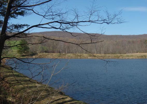
Another part of Mary Draper Ingles’ ancestral home is located on the eastern side of the New River. That property, known as Ingles Farm, was placed under easement with VOF in 2002 by Lewis Ingles “Bud” Jeffries, another direct descendant of Mary Draper Ingles. Jeffries and his son, John, have rebuilt Mary Draper Ingles’ cabin at this site and it is open to visitors at various times during the year. In addition to the historic resources on Ingles Ferry Farm, the property contains large open pastures, hayfields, mixed hardwoods, and more than one mile of frontage on the New River. All of these natural resources will be protected through the easement.

“Some easements protect farmland, some protect historic resources, some protect water quality, some protect scenic landscapes— this one protects it all,” said Hank Hartz, chairman of VOF’s board of trustees. “It’s a prime example of why Virginia’s land conservation programs are the best in the nation.”

The New River Land Trust applied for a state grant in 2007 to protect the tavern and farm. The proposal was the top-ranking Virginia Land Conservation Fund project that year. The grant allowed for the purchase of a portion of the easement at its appraised value. The three landowners—Robert Steele, Mary Ingles Barbour, and Andrew Ingles, Jr.—are donating the balance of the easement’s value.

The push to protect Ingles Ferry Farm began in 2002, when the late Roberta Ingles Steele, one of the family owners, contacted the New River Land Trust about protecting the historic property with a conservation easement. Earlier, she had also contacted VDHR for advice on maintaining the historic tavern—a centerpiece of her family’s rich heritage.

“Mrs. Steele invited me to come out and give some pointers on maintaining the building,” recalls Mike Pulice, an architectural historian with VDHR who is based in Roanoke. “I put together a little report with suggestions on what the family could do to help conserve it a little better. She paid close attention to everything I said. If there’s any property in this area that is deserving of such close and diligent attention over the years, this is certainly one of them. Mrs. Steele was an excellent steward of that property. Without her, it might not be there today.”

Mrs. Steele passed away in 2004, but her niece Mary, son Robert, and nephew Andrew continued the effort to protect the property, culminating in their generous donation of the conservation easement.

“The sight of this intact 237-year-old tavern where settlers stopped on the way west is amazing because it is virtually unchanged from days when Daniel Boone visited there,” said Elizabeth Obenshain, executive director of the New River Land Trust. “The Ingles Family has cared for this tavern and farm for generations—protecting one of Virginia’s unique historic sites. Roberta Ingles Steele contacted us 7 1/2 years ago to determine how the tavern and ferry site could be protected forever. We are elated that her son, niece, and nephew have now realized Roberta’s dream.”

VOF Finalizes 5,000-Acre Smith Mountain Easement

Nearly 5,000 acres of scenic Smith Mountain in Bedford and Pittsylvania counties are now permanently protected, thanks to the recordation of a conservation easement donated to the Commonwealth by Appalachian Power, a subsidiary of American Electric Power (AEP). The easement is being co-held by the Virginia Outdoors Foundation (VOF) and the Virginia Department of Game and Inland Fisheries (VDGIF).

The easement comprises the majority of Smith Mountain, which sits along the eastern side of Smith Mountain Lake and forms the ridge on both sides of Smith Mountain Dam. It is almost entirely forested and contains more than 10 miles of shoreline. The property allows some access for public recreational activities through VDGIF, including fishing, camping, hiking, and hunting. It also contains two rare vertebrate species and a rare ecological community identified by the state, and is adjacent to the 288-acre Bourassa State Forest. Because of its size and proximity to Smith Mountain Lake State Park and other attractions, the mountain is perhaps the mostly highly visible and recognizable landmark in the area.

“The scenic benefit to the public of preserving this mountain is enormous,” said Josh Gibson, the lead easement specialist on the project for VOF. “It’s a dominating feature on the landscape, visible from several surrounding counties and public right of ways and almost every part of Smith Mountain Lake.”

The land is part of the property acquired to construct the Smith Mountain Hydroelectric Pumped Storage project in the 1950s. The project can generate 636 megawatts of electricity.

“This easement is good for the Commonwealth, Appalachian Power customers, and for generations of Virginians who admire Smith Mountain underfoot or from afar,” said Dana Waldo, Appalachian Power president and COO. “We worked closely with the Virginia Outdoors Foundation and state officials to craft an agreement that ensures that Appalachian Power can continue to operate and maintain critical electrical equipment while at the same time permanently protecting one of Virginia’s most scenic treasures.”

The project represents the largest recorded so far in 2009 by VOF. Approximately 4,022 of the acres lie in Pittsylvania County and 973 acres lie in Bedford County. AEP announced its intention to place the land under easement in April 2008, and the project was formally recorded in late January 2009. From this point forward, VOF will serve as steward of the easement to ensure that the property’s conservation values remain permanently protected from development. VDGIF will continue to manage recreational activities.

“We’ve had a long-standing, highly successful partnership with AEP providing access for hunters, anglers, boaters, and other outdoor enthusiasts and look forward to partnering with VOF,” said VDGIF Executive Director Bob Duncan. “It’s a true pleasure to establish this conservation easement, thereby ensuring that future generations will enjoy this unique wildlife area.”

“Appalachian Power has made a significant contribution to conserving Virginia’s natural resources,” added Virginia Secretary of Natural Resources L. Preston Bryant, Jr. “The company’s donated easement at Smith Mountain is one of the largest we have received in recent years. From now on, this property will remain as it always has been.”

Purcellville Records Largest Easement in Loudoun County

The Town of Purcellville has formally filed its agreement with the Virginia Outdoor Foundation (VOF) to place 1,271 acres of land in the Blue Ridge Mountains adjacent to the Appalachian Trail and west of Hillsboro into a conservation/open-space easement. The property includes a significant portion of the watershed above the J.T. Hirst Reservoir, three springs and the reservoir itself. The reservoir provides nearly one-half of the drinking water for the town.

“I am proud of the Council taking action to protect our reservoir and its watershed,” said Purcellville Mayor Robert W. Lazaro, Jr. “The Town has a proactive environmental record including holding an easement on a ten-acre stream valley property and placing an historic easement on our Fireman’s Field property. This latest easement is the largest easement in Loudoun and the first by a municipality in Loudoun.”

“I congratulate the Town of Purcellville for their foresight to protect the watershed for its drinking-water reservoir,” said Governor Timothy M. Kaine. “This conservation easement is remarkable, and it demonstrates the significant leadership role local governments can play in preserving open space. The town’s decision will help protect local drinking water and maintain the area’s natural beauty for generations to come.”

The easement was filed with the Loudoun County Clerk of the Court on April 22, which is Earth Day.

This conservation easement is the largest granted in the Loudoun County and the first by a municipality in Loudoun County. A conservation/open-space easement is a legal document made between a landowner and a public body, such as the VOF. The easement limits present and future property development. It allows the property to be used for its traditional use, e.g., as a farm, forest, open space, and/or natural area, but protects it as well. The easement is legally recorded and bound to the deed of the property permanently.

“While the majority of easements donated to VOF are from private landowners, this project is a great example of how municipalities, too, can take advantage of the Commonwealth’s unrivaled land conservation programs,” said VOF Executive Director Bob Lee.

This donation brings the total land under easement with VOF in Loudoun County to 24,117 acres — ranking it 6th in the state. It also adds to the 330,000 acres protected so far during Gov. Kaine’s administration, which has a goal of protecting 400,000 acres by 2010. Nearly 75 percent of the land protected to date has been through VOF easements.